
Bridger Peak Elevation 9,255′
Bridger Peak is Rich County’s highpoint and high peak. I visited Bridger Peak as part of this project on September 26th, 2017.
Here’s is a video of my visit. Below the video is more from my visit. Click here to visit the Image Gallery.
September 26, 2017
I wake at 6:45 to clear skies and frosty windshields. My uncertainty about the conditions I’ll find at the Bridger Peak trailhead don’t motivate me to hurry and get loaded for the trip. I’d planned to climb Bridger last week but, because of rain and snow in the mountains, I’ve put it off until now. Even this morning, I’m not sure I’ve waited long enough for the snow to melt and the road to dry up. The forecast says I’ve got today and maybe two more good days, so I decide to go.
My plan at this point is to get to the base of the peak, climb it, come back down, and then spend the night in the back of my Toyota 4Runner. That way, I can stay late on the peak and catch the good evening light and be close the next day for the morning light as well. Photographers call the beginning and the end of each day the golden hours, when the light’s warmer and the colors deeper, and I want to catch Bridger Peak in those hours.
I’m also prepared to spend a second night, if needed, to give me more opportunities to photograph Bridger from different angles during the golden hours. My preparation takes the form of a huge pile of duffel bags, backpacks and stuff sacks that need to be loaded into the 4Runner before I leave. Almost four and half hours latter, I’m finally on my way.
The drive to the trailhead should take about an hour and fifteen minutes, but the time I spend shooting video adds another two hours and forty five minutes to that. If you watch the video, you know I’m not an actor. The first scene on Logan’s Main Street requires fifteen takes. After each failed attempt, I have to drive four blocks to get back into position to try again. That forty four seconds of video takes forty five minutes to shoot. The remaining extra two hours is spent moving the camera around and driving sections of road four different times to get the shots I want. This puts me at the snow covered trailhead at 3:15 in the afternoon with a pile of dead GoPro batteries and a memory card full of what feels like wasted time.
I spend the next forty five minutes putting on my boots, gaiters and a jacket; shoving food in my face; checking the trail to see how slick it is; and walking around in circles evaluating my options. These options include various combinations of the following: charging the batteries for the GoPro so I can use it on the hike; leaving the GoPro and using my phone for video; leaving for the hike now hoping to make it up and back tonight; loading gear in a pack, climbing and spending the night on the peak and then coming down in the morning; staying the night here in the 4Runner and hiking in the morning; going home tonight and coming back in the morning to hike.
The noticeable setting of the sun somehow shakes me out of my self-induced haze to the realization that the forty five minutes I’ve spent trying to decide what to do would have almost put me on the summit. I grab a pack and start searching for gear to stuff in it; snacks, water, an extra jacket, gloves, a warm hat, a headlight, miscellaneous emergency gear and my camera and tripod. This takes another thirty minutes. Next I grab my phone for video and my trekking poles to help keep me on my feet, and start hiking.
Four thirty in the afternoon is not my preferred time to start a hike, especially when the ground is slick and snowy. But on this late September afternoon, for me, on this hike, everything goes perfectly. In just a few minutes, I’m on a sunny slope enjoying warmth that surprises me, having just left the cold shade. The ground is slippery, but when I stay to the side of the trail in the brush, the footing is good. It’s steep, but with a steady pace, I’m making good time. About forty minutes into the hike, the trail becomes faint. I’ve worked my way into some mixed pines and quaking aspen where the slope is not as steep. Because I’ve done this hike before with my sons, I know that, from here, the trail leads south, away from the peak, and, if I follow it, I’ll have to leave the trail at a point below a band of rocks, climb up through the rocks and head east to reach the ridge, then follow the ridge north to the summit. Instead, I opt to take a more direct route and leave the trail now heading northeast. Fifteen minutes later, I’m through the trees and on the ridge and in another five minutes, I’m on the summit.
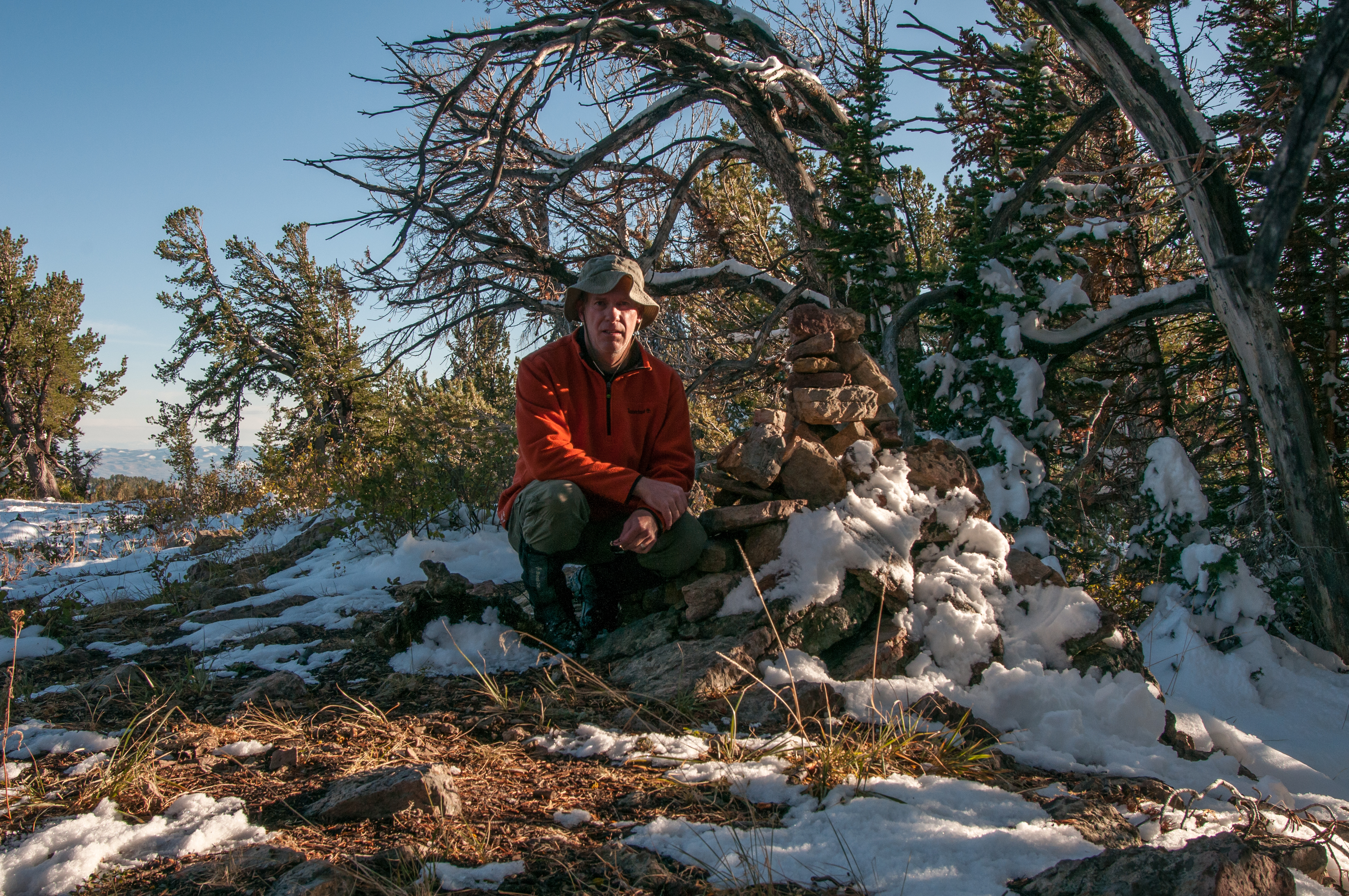
I ditch my pack and hang it from a tree limb. Now I take a selfie with the summit cairn behind me. Surprised to find I have cellphone service, I post the selfie on Instagram. Already I feel the cold creeping in. Knowing that staying hydrated helps fight the cold, I dig out my water and drink. Next I eat a quick snack. My goals for today are to climb the peak, photograph it, and capture video of the trip. At this point, I’ve climbed the peak and the GoPro batteries are all dead from all the video I’ve shot. All that leaves is to photograph the peak. I’m getting colder, my fingers are getting stiff and slow. I dig out my camera and set it up on the tripod. I get shots of the summit cairn, even snapping two using the self-timer so I can run and kneel next to the pile of rocks. I walk to the east and frame shots of a twisted tree trunk with Bear Lake in the background. Now I walk south along the ridge and find more views of the lake to shoot. I’m feeling chilled and becoming anxious about the possibility of making my decent in the dark. I turn to the west and walk to that side of the ridge where I shoot another twisted tree on the skyline. I can’t believe it, but I’ve been here for almost an hour. I walk back to the summit where I put my camera away. I use my phone to make a quick video of myself on the peak and what I can see from here. I dig out a pair of gloves, pull on my pack, grab my trekking poles and start down.
Before leaving the ridge and heading back into the trees, I turn and take another look at the summit. I wish I had gotten here earlier and could spend more time. I replay in my mind the axiom I’ve heard so many times, “Getting to the top is optional. Getting down is mandatory.” I know this isn’t Everest, but right now, it also applies to Bridger Peak. When breaking the cardinal rule to never hike alone, I impose a substantial safety factor to compensate.
I walk into the trees, following my own footprints back towards the 4Runner. My gloves are starting to help bring life back into my fingers. I notice that my perspective while walking downhill is different from while walking uphill. I take a different path through the trees and brush and soon loose sight of my uphill footprints. I come out of the trees onto a brush and snow covered slope. From here, I can see my destination, my 4Runner waiting right where I left it. I notice the absolute silence where I am. With my phone, I take a one minute video of the quakies and pines across the draw from where I stand, enjoying the golden hour I didn’t wait for on the summit. I know that anyone else who views the video will think the silence is a product of the limited capacity of the cellphone microphone, but I’ll always know it really was that quite.
Reluctantly, I start walking again. Now I’m choosing my route based on the steepness of the slope, not on avoiding trees and brush. I’m in a race with the fading light. My headlight is easy to reach, but I hope I don’t need it. I know I’m making progress, but the 4Runner never seems any closer. It’s a phenomenon I’ve often discussed with family and friends. When paddling on the last day of a Yellowstone Lake canoe trip and rounding the last point bringing the destination into view, or hiking out of Garnet Canyon in Grand Teton National Park and reaching the point on the trail where the asphalt starts, you know you’re close, but it seems to take forever to get to the end.
Finally, I’m in the bottom of Garden City Canyon. Next is a short climb up the other side to the road and then the 4Runner. I’m hoping the uphill climb helps me warm up from the chill forty minutes of downhill travel has brought on. This slope was slippery on the way in but now, with a frozen crust on it, it’s not too bad. The top of the hill brings the welcome sight of my trusty 4Runner.
I open the two driver’s side doors and dump my pack in the back. Now I need to decide what I’m doing next. My plan to spend the night in the back of the 4Runner isn’t sounding very fun right now. I’m not even sure there’s room in the front seats for all the stuff I’d have to stash there to make room for my sleeping bag in the back. I make a short video about having climbed Bridger Peak with my phone, procrastinating the decision I still have to make.
As one who suffers from acid reflux, I stay upright for at least three hours after eating to avoid the heartburn, regurgitation and even vomiting that can occur when I don’t. This condition influences what I do every evening of my life, and now, it weighs heavily on my decision to eat or skip dinner. If I eat, I need to find a way to stay upright and warm for three hours, either in the front seats of the 4Runner or in the back where the seats are laid down. If I skip dinner, I can get in my sleeping bag right now to stay warm, but I won’t have any fuel in me to generate heat during the night.
Another option I consider is to eat, jump in the 4Runner and go home. The drive’s over an hour long so that would leave less than two hours that I’d have to stay upright. And, if I was home, I’d talk with my wife about her day as well as share my day with her, taking even more time. Of course I’d shower before going to bed and that would eat up some time too. Plus, all of this time would be spent in the warmth of the 4Runner and the comfort of my home. This is simply a no-brainer. Bridger Peak and the area around it is beautiful, but I can’t see any of it from inside the 4Runner through ten hours of darkness. My decision is made. I dig out some granola bars, eat and wash them down with water and head home.
P.S. I found that the front seats of the 4Runner will hold all my gear leaving plenty of room to sleep in the back. Useful information for next time.
Stats for Bridger Peak
 On Route Miles Driven 7.4
 ![]() Side Trip
Side Trip
![]() On Route Off Road Miles Driven 7.4
On Route Off Road Miles Driven 7.4
![]() Off Route Miles Driven 93.6
Off Route Miles Driven 93.6
![]() Off Route Off Road Miles Driven 0
Off Route Off Road Miles Driven 0
![]() Total Miles Driven 101
Total Miles Driven 101
![]() On Route Miles Hiked 1.86
On Route Miles Hiked 1.86
![]() Off Route Miles Hiked 0
Off Route Miles Hiked 0
![]() Total Miles Hiked 1.86
Total Miles Hiked 1.86
![]() On Route Elevation Gain 920′
On Route Elevation Gain 920′
![]() Off Route Elevation Gain 0′
Off Route Elevation Gain 0′
![]() Total Elevation Gain 920′
Total Elevation Gain 920′
![]() Video Shot (minutes:seconds) 66:37
Video Shot (minutes:seconds) 66:37
![]() Video Used (minutes:seconds) 23:30
Video Used (minutes:seconds) 23:30
![]() Images Shot 31
Images Shot 31
![]() Images Used 3
Images Used 3
![]() Nights Spent 0
Nights Spent 0
![]() Meals Eaten 2
Meals Eaten 2
![]() Snacks Eaten 2
Snacks Eaten 2