Utah has the highest average county highpoint elevation in the United States. The highpoint of a county is usually the top of a mountain, but not always. Sometimes the highpoint is a spot on a ridge or on the side of a mountain where a county line crosses it. That’s why some counties have both a highpoint and a high peak. This is the case in two of Utah’s counties. Depending on whether you use the county highpoint or the county high peak for these two counties, Utah’s average county highpoint elevation is either 435′ or 430′ higher than the second highest average county highpoint elevation in the United States, which is Colorado’s.
Often, a county line is defined as the ridgeline of a mountain. This means the mountain’s peak can be in two or more counties. This happens three times in Utah resulting in three peaks representing six counties.
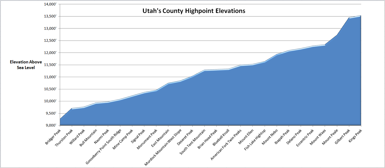
Here’s a list of Utah’s county highpoints and high peaks sorted from lowest to highest. I have visited those with a check mark next to them. Click on the links in the list for more information about the point and for a report of my visit there. Below the list is a chart of Utah’s county highpoint elevations.
| County | High Point | Elevation | High Peak | Elevation | ||
| Rich | ✓ | Bridger Peak | 9,255′ | ✓ | Bridger Peak | 9,255′ |
| Davis | Thurston Peak | 9,706′ | Thurston Peak | 9,706′ | ||
| Morgan | Thurston Peak | 9,706′ | Thurston Peak | 9,706′ | ||
| Weber | Willard Peak | 9,763′ | Willard Peak | 9,763′ | ||
| Box Elder | Bull Mountain | 9,934′ | Bull Mountain | 9,934′ | ||
| Cache | Naomi Peak | 9,979′ | Naomi Peak | 9,979′ | ||
| Kane | Gooseberry Point South Ridge | 10,080′ | Andy Nelson Peak | 10,027′ | ||
| Millard | Mine Camp Peak | 10,222′ | Mine Camp Peak | 10,222′ | ||
| Washington | Signal Peak | 10,365′ | Signal Peak | 10,365′ | ||
| Carbon | Monument Peak | 10,452′ | Monument Peak | 10,452′ | ||
| Emery | East Mountain | 10,743′ | East Mountain | 10,743′ | ||
| Wasatch | Murdock Mountain West Slope | 10,840′ | Mount Cardwell | 10,743′ | ||
| Tooele | Deseret Peak | 11,031′ | Deseret Peak | 11,031′ | ||
| Sanpete | South Tent Mountain | 11,285′ | South Tent Mountain | 11,285′ | ||
| Iron | Brian Head Peak | 11,307′ | Brian Head Peak | 11,307′ | ||
| Wayne | Bluebell Knoll | 11,328′ | Bluebell Knoll | 11,328′ | ||
| Salt Lake | American Fork Twin Peaks | 11,489′ | American Fork Twin Peaks | 11,489′ | ||
| Garfield | Mount Ellen | 11,522′ | Mount Ellen | 11,522′ | ||
| Sevier | Fish Lake Hightop | 11,633′ | Fish Lake Hightop | 11,633′ | ||
| Utah | Mount Nebo | 11,928′ | Mount Nebo | 11,928′ | ||
| Juab | Ibapah Peak | 12,087′ | Ibapah Peak | 12,087′ | ||
| Beaver | Delano Peak | 12,169′ | Delano Peak | 12,169′ | ||
| Piute | Delano Peak | 12,169′ | Delano Peak | 12,169′ | ||
| Daggett | Eccentric Peak | 12,276′ | Eccentric Peak | 12,276′ | ||
| Uintah | Eccentric Peak | 12,276′ | Eccentric Peak | 12,276′ | ||
| Grand | Mount Waas | 12,331′ | Mount Waas | 12,331′ | ||
| San Juan | Mount Peale | 12,721′ | Mount Peale | 12,721′ | ||
| Summit | Gilbert Peak | 13,442′ | Gilbert Peak | 13,442′ | ||
| Duchesne | Kings Peak | 13,528′ | Kings Peak | 13,528′ | ||
| Average County Highpoint Elevation | 11,226′ | Average County High Peak Elevation | 11,221′ | |||

